Aeronautical engineering: providing the gift of sight for drones
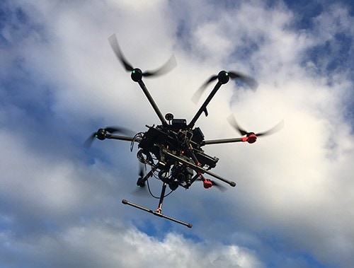
PhD student Anastasia Volkova is developing an alternative way for drones to see in areas they are unable to navigate by GPS satellite. She hopes visual navigation algorithms will change the way drones operate.
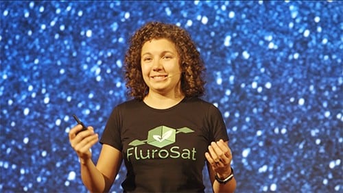
PhD student Anastasia Volkova
With the recent increase in demand for satellite navigation and communication, and the potential for commercial application for drones, questions are now being asked as to whether the level of autonomy for these unmanned aerial vehicles can go further.
Accordingly, Aeronautical Engineering Doctor of Philosophy (PhD) student, Anastasia Volkova hopes to bestow the gift of sight on these popular and highly-applicable machines.
“My research in visual navigation algorithms for environments where the Global Positioning System (GPS) is unavailable aims to build autonomous systems for localisation of drones. I started working in this area before they were available to consumers and before they became an alternative to a GoPro camera,” Anastasia says.
“The motivation behind my research is the development of reliable navigation – as an alternative to the GPS signal – using visual equipment available on-board the aerial platform, such as the downward-looking camera. It seems logical to be utilising all possible means to improve positioning accuracy.”
The main objective of the algorithm is improving the surveillance capability, by accurately tracking and mapping the movers detected in the imagery into the world frame. This ‘in-flight’ tracking algorithm can be used for traffic analysis applied in urban planning or for safety and security applications, such as tracking a criminal with a drone in the sky.
Ultimately Anastasia’s research will provide a drone with a capability to ‘see’ where it is in the world and figure out where it is going based on visual clues such as the outlines of roads and rivers.
Now in her third year, Anastasia has already conducted simulations to assess the viability of her algorithm and is validating her approach on the real-world footage captured.
“This is definitely the most interesting and challenging part of the project, as I get to see my research turning from an intellectual pursuit into a practical tool for solving modern world navigation challenges,” she says.
“And there is nothing more exciting for an engineer than to see their developments applied!”
Alongside the completion of her PhD thesis, Anastasia involves herself in FluroSat, a start-up in collaboration with industry bodies such as the Cotton Research and Development Corporation (CRDC), that uses drones and satellites to diagnose crop stress to help farmers cut fertiliser costs and improve yields.
“We can provide a farmer with the information on the stress levels and nutrient requirements of the crops around the paddock (such as how much nitrogen and water needs to be applied) calculated using our advanced crop modelling and data processing tools,” she adds.
“As we grow, we are looking for remote sensing experts to join our team to tackle one of the most intriguing and vital challenges of the modern world: food security.”
Related articles
Sydney performs strongly in engineering and computer science rankings
